Mount Teide is a volcano on Tenerife in the Canary Islands, Spain

We left the city of Los Cristianos and headed for Mount Teide
We left the city of Los Cristianos and headed for Mount Teide.
While we drive up to the mountain the species of trees vary with each new level of altitude
While we drive up to the mountain the species of trees vary with each new level of altitude.
I guess that the winding road to Mount Teide is very tedious for the driver
I guess that the winding road to Mount Teide is very tedious for the driver.
The pine forests of Tenerife
The pine forests of Tenerife.
Vilaflor de Chasna, with an altitude of 1400 m, is the highest village of Tenerife, situated south the Teide volcano
Vilaflor de Chasna, with an altitude of 1400 m, is the highest village of Tenerife, situated south the Teide volcano.
Las Lajas Campsite is of modest size and situated high up the mountain
Las Lajas Campsite is of modest size and situated high up the mountain.
The forested slopes
The forested slopes.
While we travel to Mount Teide we observe that forested slopes are covered with Canary pines
While we travel to Mount Teide we observe that forested slopes are covered with Canary pines.
Canary pines are very tall and straight, they grow only in the Canaries
Canary pines are very tall and straight, they grow only in the Canaries.
Pinus canariensis, the Canary Island pine, is a species of gymnosperm in the coniferous family Pinaceae
Pinus canariensis, the Canary Island pine, is a species of gymnosperm in the coniferous family Pinaceae.
Pinus canariensis, the Canary Island pine, is a large, evergreen tree native and endemic to the outer Canary Islands
Pinus canariensis, the Canary Island pine, is a large, evergreen tree native and endemic to the outer Canary Islands.
Mount Teide is the Canary Islands most visited tourist attraction
Mount Teide is the Canary Islands most visited tourist attraction.
The closer I travel to Mount Teide, the more mountainous landscape I see
The closer I travel to Mount Teide, the more mountainous landscape I see.
“Roques de García” tourist attraction marks the approach to Mount Teide
“Roques de García” tourist attraction marks the approach to Mount Teide.
In the middle of Tenerife island sits Mount Teide, which is 3,717.98 meters meters high and is the highest mountain in Spain
In the middle of Tenerife island sits Mount Teide, which is 3,717.98 meters meters high and is the highest mountain in Spain.
Parador de Cañadas del Teide is a 2-star hotel
Parador de Cañadas del Teide is a 2-star hotel.
This sculpture is a tribute to the spanish naturalist and geologist Telesforo Bravo Expósito
This sculpture is a tribute to the spanish naturalist and geologist Telesforo Bravo Expósito.
A luxurious green shrub is on the background of “Roques de García” tourist attraction
A luxurious green shrub is on the background of “Roques de García” tourist attraction.
Parador del Teide bus station is located near Ermita de las Nieves church
Parador del Teide bus station is located near Ermita de las Nieves church.
This natural landscape surrounds Mount Teide
This natural landscape surrounds Mount Teide.
This is the entrance to Teide National Park
This is the entrance to Teide National Park.
A green shrub which grows at Parador del Teide bus station
A green shrub which grows at Parador del Teide bus station.
Bus line 342 “Playa de Las Américas - Las Cañadas del Teide” will get you to the Сable Сar from the south of the island
Bus line 342 “Playa de Las Américas - Las Cañadas del Teide” will get you to the Сable Сar from the south of the island.
Ermita de las Nieves church
Ermita de las Nieves church.
Ermita de las Nieves church is on the background of Mount Teide
Ermita de las Nieves church is on the background of Mount Teide.
The withered plant is in focus on the background of Teide National Park which is out of focus
The withered plant is in focus on the background of Teide National Park which is out of focus.
The withered plant is out of focus on the background of Teide National Park which is in focus
The withered plant is out of focus on the background of Teide National Park which is in focus.
Teide Cable Car lower station
Teide Cable Car lower station.
A technical staircase is located under the ceiling of Teide Cable Car lower station
A technical staircase is located under the ceiling of Teide Cable Car lower station.
Crowd control barriers are mounted on Teide Cable Car lower station
Crowd control barriers are mounted on Teide Cable Car lower station.
Teide Cable Car is an awesome trip to Spain's highest volcano
Teide Cable Car is an awesome trip to Spain's highest volcano.
A Teide Cable Car cabin can hold a maximum of 44 passengers
A Teide Cable Car cabin can hold a maximum of 44 passengers.
Teide Cable Car celebrated its 40th anniversary in 2012
Teide Cable Car celebrated its 40th anniversary in 2012.
Teide Cable Car upper station
Teide Cable Car upper station.
This viewing platform is located at the foot of Teide Cable Car upper station
This viewing platform is located at the foot of Teide Cable Car upper station.
The history of Teide Cable Car
The history of Teide Cable Car.
The open door leads to the public toilet which belongs to Teide Cable Car upper station
The open door leads to the public toilet which belongs to Teide Cable Car upper station.
This view opens from the viewing platform of Teide Cable Car upper station
This view opens from the viewing platform of Teide Cable Car upper station.
People are on the viewing platform of Teide Cable Car upper station
People are on the viewing platform of Teide Cable Car upper station.
The information board shows directions both to the crater of Mount Teide “Route #10” and to the Mirador La Fortaleza observation deck “Route #11”
The information board shows directions both to the crater of Mount Teide “Route #10” and to the Mirador La Fortaleza observation deck “Route #11”.
It is the beginning of “Route #10” which leads to the crater of Mount Teide
It is the beginning of “Route #10” which leads to the crater of Mount Teide.
A permit for the “Route #10” which leads to the crater of Mount Teide is required at the checkpoint
A permit for the “Route #10” which leads to the crater of Mount Teide is required at the checkpoint.
This lava landscape surrounds you at the beginning of “Route #10” which leads to the crater of Mount Teide
This lava landscape surrounds you at the beginning of “Route #10” which leads to the crater of Mount Teide.
The “Route #10” is a walkway that should be passed by everyone who visits Mount Teide
The “Route #10” is a walkway that should be passed by everyone who visits Mount Teide.
Teide National Park is the biggest park on the Canary Islands
Teide National Park is the biggest park on the Canary Islands.
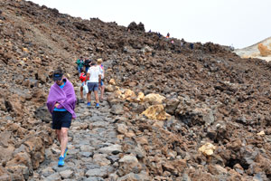
A stone stairway is on the “Route #10” walkway
A stone stairway is on the “Route #10” walkway.
The sun is coming out from behind the clouds
The sun is coming out from behind the clouds.
A unique landscape of craters, volcanoes and rivers of petrified lava surrounds Teide peak
A unique landscape of craters, volcanoes and rivers of petrified lava surrounds Teide peak.
Teide Cable Car upper station as seen from above
Teide Cable Car upper station as seen from above.
This is one of the numerous viewing platforms on the walkway which leads to the Mount Teide peak
This is one of the numerous viewing platforms on the walkway which leads to the Mount Teide peak.
The Route #12 “Pico Viejo Vantage Point” as seen from above
The Route #12 “Pico Viejo Vantage Point” as seen from above.
The Route #12 “Pico Viejo Vantage Point” as well as the other routes is managed by Teide National Park
The Route #12 “Pico Viejo Vantage Point” as well as the other routes is managed by Teide National Park.
A waste container is on the walkway leading to the Mount Teide peak
A waste container is on the walkway leading to the Mount Teide peak.
The Route #10 “Telesforo Bravo” leads to the crater of Mount Teide
The Route #10 “Telesforo Bravo” leads to the crater of Mount Teide.
The route to the crater of Mount Teide takes you to Spain's highest peak
The route to the crater of Mount Teide takes you to Spain's highest peak.
It is wise to climb slowly, making the most of short stops to feel the island throbbing beneath your feet
It is wise to climb slowly, making the most of short stops to feel the island throbbing beneath your feet.
How to find the trail which leads to the crater of Mount Teide?
It is wise to climb slowly, making the most of short stops to feel the icy air around you
It is wise to climb slowly, making the most of short stops to feel the icy air around you.
The first few hundred meters from Teide Cable Car upper station, the slope of route leading to the peak is quite gentle
The first few hundred meters from Teide Cable Car upper station, the slope of route leading to the peak is quite gentle.
The closer to the Mount Teide peak the steeper the slope
The closer to the Mount Teide peak the steeper the slope.
Teide National Park was named a world heritage site by UNESCO in 2007
Teide National Park was named a world heritage site by UNESCO in 2007.
The Route #12 “Pico Viejo Vantage Point” as seen from the distance
The Route #12 “Pico Viejo Vantage Point” as seen from the distance.
Mount Teide National Park is an unspoiled wilderness ranging from volcanic rock formations to fields of wildflowers and pine forests
Mount Teide National Park is an unspoiled wilderness ranging from volcanic rock formations to fields of wildflowers and pine forests.
In 1954, Mount Teide and its vast and unspoiled natural surroundings achieved National Park status for its ecological and volcanic importance
In 1954, Mount Teide and its vast and unspoiled natural surroundings achieved National Park status for its ecological and volcanic importance.
Mount Teide National Park is the oldest and largest of the Canary Islands National Parks
Mount Teide National Park is the oldest and largest of the Canary Islands National Parks.
The volcanic nature of Mount Teide National Park fits the best for captivating hiking trails and routes
The volcanic nature of Mount Teide National Park fits the best for captivating hiking trails and routes.
In this photo you can see where all three routes start from Teide Cable Car upper station
In this photo you can see where all three routes start from Teide Cable Car upper station.
The otherworldly landscapes of Mount Teide volcanic surroundings will leave you speechless
The otherworldly landscapes of Mount Teide volcanic surroundings will leave you speechless.
The Route #10 “Telesforo Bravo” is on the background of Route #12 “Pico Viejo Vantage Point”
The Route #10 “Telesforo Bravo” is on the background of Route #12 “Pico Viejo Vantage Point”.
One of the most exciting experiences Teide National Park has in store for you is a ride on the cable car
One of the most exciting experiences Teide National Park has in store for you is a ride on the cable car.
The Route #12 “Pico Viejo Vantage Point” as seen from a bird's-eye view
The Route #12 “Pico Viejo Vantage Point” as seen from a bird's-eye view.
Teide Cable Car lower station stands at an altitude of 2356 m and climbs up to the upper station at 3555 m
Teide Cable Car lower station stands at an altitude of 2356 m and climbs up to the upper station at 3555 m.
It takes roughly 40 minutes to get to the Mount Teide peak
It takes roughly 40 minutes to get to the Mount Teide peak.
Teide National Park is centered on Mount Teide, the highest mountain of Spain (3,717.98 meters metres high)
Teide National Park is centered on Mount Teide, the highest mountain of Spain (3,717.98 meters metres high).
Teide National Park has an area of 18990 hectares located in the municipality of La Orotava
Teide National Park has an area of 18990 hectares located in the municipality of La Orotava.
The similarity between Teide National Park and the planet Mars have turned this spot to the place for studies related to the red planet
The similarity between Teide National Park and the planet Mars have turned this spot to the place for studies related to the red planet.
The “Route #10” which leads to the crater of Mount Teide is steep and winding
The “Route #10” which leads to the crater of Mount Teide is steep and winding.
The altitude and the strong smell of sulphur given off by the numerous fumaroles in the area make walking difficult
The altitude and the strong smell of sulphur given off by the numerous fumaroles in the area make walking difficult.
Different equipments are used for measurements of volcanic activity on the surface of Mount Teide crater
Different equipments are used for measurements of volcanic activity on the surface of Mount Teide crater.
The final stretch of “Route #10” which leads to the crater of Mount Teide goes along the circumference of crater
The final stretch of “Route #10” which leads to the crater of Mount Teide goes along the circumference of crater.
Once at the top, the yellowy-green depths of the crater of Mount Teide conjure up violent eruptions of the past
Once at the top, the yellowy-green depths of the crater of Mount Teide conjure up violent eruptions of the past.
This volcanic rock is located at the edge of Mount Teide crater
This volcanic rock is located at the edge of Mount Teide crater.
Mount Teide is the world's third largest ocean-island volcano and is still active
Mount Teide is the world's third largest ocean-island volcano and is still active.
This metallic chain serves as a defense barrier for tourists walking along the edge of Mount Teide crater
This metallic chain serves as a defense barrier for tourists walking along the edge of Mount Teide crater.
There are cloud formations under the Mount Teide peak
There are cloud formations under the Mount Teide peak.
Teide Cable Car upper station as seen from the Mount Teide peak
Teide Cable Car upper station as seen from the Mount Teide peak.
A couple of tourists are on the stone footpath lying along the Mount Teide crater
A couple of tourists are on the stone footpath lying along the Mount Teide crater.
The Mirador La Fortaleza observation deck as seen from the Mount Teide peak
The Mirador La Fortaleza observation deck as seen from the Mount Teide peak.
The Mount Teide crater is quite cold and one should be prepared with a coat and sensible footwear & headgear
The Mount Teide crater is quite cold and one should be prepared with a coat and sensible footwear & headgear.
The pure, clean air of Spain's highest peak will refresh your lungs as you wander amidst solid volcanic magma
The pure, clean air of Spain's highest peak will refresh your lungs as you wander amidst solid volcanic magma.
The Mount Teide crater
The Mount Teide crater.
Rocks of the Mount Teide crater have greenish and yellowish colours
Rocks of the Mount Teide crater have greenish and yellowish colours.
The Mount Teide peak gives an awesome opportunity to be higher than clouds
The Mount Teide peak gives an awesome opportunity to be higher than clouds.
The Mount Teide crater is full of sulfuric smells rising up from hidden under the surface numerous fumaroles
The Mount Teide crater is full of sulfuric smells rising up from hidden under the surface numerous fumaroles.
The clouds as seen from the Mount Teide peak
The clouds as seen from the Mount Teide peak.
The clouds as seen from the crater of Mount Teide
The clouds as seen from the crater of Mount Teide.
This is the highest rock of Mount Teide peak, it is the 3,717.98 meters (12,198 ft) highest point
This is the highest rock of Mount Teide peak, it is the 3,717.98 meters (12,198 ft) highest point.
Mount Teide is the most visited natural wonder of Spain
Mount Teide is the most visited natural wonder of Spain.
The Mirador La Fortaleza observation deck is the endpoint of “Route #11” trail
The Mirador La Fortaleza observation deck is the endpoint of “Route #11” trail.
This fenced stone path is located at the most top of Mount Teide peak
This fenced stone path is located at the most top of Mount Teide peak.
This is the 3,717.98 meters highest point, which is the highest point above sea level in the islands of the Atlantic
This is the 3,717.98 meters highest point, which is the highest point above sea level in the islands of the Atlantic.
This metallic chain keeps tourists in the safety area on the highest point of Mount Teide
This metallic chain keeps tourists in the safety area on the highest point of Mount Teide.
The clouds as seen from the highest point of Mount Teide
The clouds as seen from the highest point of Mount Teide.
The edge of a multi-kilometer wide cloud is located much lower the Mount Teide peak
The edge of a multi-kilometer wide cloud is located much lower the Mount Teide peak.
The Mount Teide crater is an ancient crater, rimmed by red and ochre walls of rock
The Mount Teide crater is an ancient crater, rimmed by red and ochre walls of rock.
The geological structure of the Mount Teide crater is quite distinct from the mountainous landscape outside its borders
The geological structure of the Mount Teide crater is quite distinct from the mountainous landscape outside its borders.
Take time to appreciate the amazing views which open from the Mount Teide crater
Take time to appreciate the amazing views which open from the Mount Teide crater.
The edge of Mount Teide crater is mostly ochre in color
The edge of Mount Teide crater is mostly ochre in color.
Admire the craggy landscape of weather-beaten rock formations inside the Mount Teide crater!
The metallic chain which keeps tourists in safety starts on the Mount Teide crater in this place
The metallic chain which keeps tourists in safety starts on the Mount Teide crater in this place.
The metallic chain marks the border on the Mount Teide peak which shouldn't be overstepped
The metallic chain marks the border on the Mount Teide peak which shouldn't be overstepped.
The rocks around the Mount Teide crater are yellow and white
The rocks around the Mount Teide crater are yellow and white.
This view opens from the Mount Teide crater in a cloudy day
This view opens from the Mount Teide crater in a cloudy day.
The red edge of Mount Teide crater is on the background of Teide National Park
The red edge of Mount Teide crater is on the background of Teide National Park.
I took my pregnant wife to Mount Teide and she has easily reached the crater
I took my pregnant wife to Mount Teide and she has easily reached the crater.
Teide National Park as seen from the Mount Teide crater
Teide National Park as seen from the Mount Teide crater.
The wisps of sulphuric steam which escape from fumaroles is a reminder that Mount Teide is a dormant volcano, which last erupted in 1909
The wisps of sulphuric steam which escape from fumaroles is a reminder that Mount Teide is a dormant volcano, which last erupted in 1909.
The bottom of Mount Teide crater is covered with yellow-green sulfur
The bottom of Mount Teide crater is covered with yellow-green sulfur.
The Mirador La Fortaleza observation platform as seen from the edge of Mount Teide crater
The Mirador La Fortaleza observation platform as seen from the edge of Mount Teide crater.
The metallic chain is in focus on the background of clouds floating below Mount Teide which are out of focus
The metallic chain is in focus on the background of clouds floating below Mount Teide which are out of focus.
The metallic chain is out of focus on the background of clouds floating below Mount Teide which are in focus
The metallic chain is out of focus on the background of clouds floating below Mount Teide which are in focus.
How to get to Teide Cable Car upper station on foot from the Refugio Altavista lodging?
The presence of sulfur can be detected from the yellow spots in the Mount Teide crater and the typical bad smell, like a rotten egg
The presence of sulfur can be detected from the yellow spots in the Mount Teide crater and the typical bad smell, like a rotten egg.
This place in the Mount Teide crater was remembered to me by the most strong smell of sulfur
This place in the Mount Teide crater was remembered to me by the most strong smell of sulfur.
Yellow spots created by the sulfur crystals are everywhere in the Mount Teide crater
Yellow spots created by the sulfur crystals are everywhere in the Mount Teide crater.
Greenish-yellow spots in the Mount Teide crater remind us about the active nature of the volcano
Greenish-yellow spots in the Mount Teide crater remind us about the active nature of the volcano.
Teide Cable Car upper station is in approximation, the photo was made from the Mount Teide peak
Teide Cable Car upper station is in approximation, the photo was made from the Mount Teide peak.
Mount Teide is the third highest volcanic structure in the world after Mauna Kea and Mauna Loa in Hawaii
Mount Teide is the third highest volcanic structure in the world after Mauna Kea and Mauna Loa in Hawaii.
You can only begin the ascent if you are in possession of a permit issued by the offices of the national park
You can only begin the ascent if you are in possession of a permit issued by the offices of the national park.
Mount Teide as a volcano is the third most voluminous structure in the world after Mauna Loa and Mauna Kea in Hawaii
Mount Teide as a volcano is the third most voluminous structure in the world after Mauna Loa and Mauna Kea in Hawaii.
Obtaining the Pico del Teide access permit using the “Telesforo Bravo Trail” (#10 in the Park Network) is compulsory
Obtaining the Pico del Teide access permit using the “Telesforo Bravo Trail” (#10 in the Park Network) is compulsory.
The “Telesforo Bravo Trail” (#10 in the Park Network) is the only one which connects La Rambleta (3,555 m) with the summit (3,717.98 m)
The “Telesforo Bravo Trail” (#10 in the Park Network) is the only one which connects La Rambleta (3,555 m) with the summit (3,717.98 m).
The “Telesforo Bravo Trail” (#10 in the Park Network) is done on foot
The “Telesforo Bravo Trail” (#10 in the Park Network) is done on foot.
The route #12 “Pico Viejo Vantage Point” is at the bottom of the photograph
The route #12 “Pico Viejo Vantage Point” is at the bottom of the photograph.
Teide National Park has had to regulate visits to the Mount Teide peak in order to protect this fragile area
Teide National Park has had to regulate visits to the Mount Teide peak in order to protect this fragile area.
Teide National Park has had to regulate visits to the Mount Teide peak in order to offer visitors a higher quality and safer experience
Teide National Park has had to regulate visits to the Mount Teide peak in order to offer visitors a higher quality and safer experience.
Sparsely scattered yellowish flowers can be seen in late August among the stones of Mount Teide
Sparsely scattered yellowish flowers can be seen in late August among the stones of Mount Teide.
The “Telesforo Bravo Trail” (#10 in the Park Network) is very steep sometimes
The “Telesforo Bravo Trail” (#10 in the Park Network) is very steep sometimes.
Green grass is amidst the stones on the “Telesforo Bravo Trail” (#10 in the Park Network)
Green grass is amidst the stones on the “Telesforo Bravo Trail” (#10 in the Park Network).
Tiny shrubs of green grass grow on the red-black rock of Mount Teide
Tiny shrubs of green grass grow on the red-black rock of Mount Teide.
Because there is a daily quota of visitors that can access this area every day, a permit must be obtained in order to visit Pico del Teide
Because there is a daily quota of visitors that can access this area every day, a permit must be obtained in order to visit Pico del Teide.
The steep slope of Mount Teide
The steep slope of Mount Teide.
Teide Cable Car upper station is called La Rambleta
Teide Cable Car upper station is called La Rambleta.
The yellow-whitish surroundings of trail #12 “Pico Viejo Vantage Point”
The yellow-whitish surroundings of trail #12 “Pico Viejo Vantage Point”.
Tiny shrubs of green grass bloom with white flowers on the red-black slope of Mount Teide
Tiny shrubs of green grass bloom with white flowers on the red-black slope of Mount Teide.
Even if you used the cableway to reach La Rambleta, following the “Telesforo Bravo Trail” (#10) is considered to be a separate activity
Even if you used the cableway to reach La Rambleta, following the “Telesforo Bravo Trail” (#10) is considered to be a separate activity.
The trail #12 “Pico Viejo Vantage Point”
The trail #12 “Pico Viejo Vantage Point”.
Four lovely women are on the “Telesforo Bravo Trail” (#10 in the Park Network)
Four lovely women are on the “Telesforo Bravo Trail” (#10 in the Park Network).
Here are photographed both the trail #10 (at the right side) and the trail #11 (in the center)
Here are photographed both the trail #10 (at the right side) and the trail #11 (in the center).
Although the permit allows you to visit the peak, you are not authorized to leave the trail #10 or enter into the Mount Teide crater at any time
Although the permit allows you to visit the peak, you are not authorized to leave the trail #10 or enter into the Mount Teide crater at any time.
The last section of the climb to Teide volcano peak
The last section of the climb to Teide volcano peak.
The green alpine grass grows on the slope of Teide volcano
The green alpine grass grows on the slope of Teide volcano.
There are no rich diversity of vegetation on Mount Teide in August yet some flowers can be found
There are no rich diversity of vegetation on Mount Teide in August yet some flowers can be found.
The trail #10 goes up the southeast slope, drawing ever closer to the summit from where you can contemplate the magnificent crater
The trail #10 goes up the southeast slope, drawing ever closer to the summit from where you can contemplate the magnificent crater.
The total distance which the trail #10 covers is approximately 650 meters with a climb of about 163 meters
The total distance which the trail #10 covers is approximately 650 meters with a climb of about 163 meters.
This is the gate where the Pico del Teide access permit must be shown
This is the gate where the Pico del Teide access permit must be shown.
This trail #11 leads to the Mirador La Fortaleza observation platform
This trail #11 leads to the Mirador La Fortaleza observation platform.
The beginning of the trail #10 is located at an altitude of 3555 meters and the highest point (Pico del Teide) is 3717.98 meters
The beginning of the trail #10 is located at an altitude of 3555 meters and the highest point (Pico del Teide) is 3717.98 meters.
This information board tells about the park recommendations
This information board tells about the park recommendations.
The environmental conditions of the Mount Teide area, including less oxygen, could affect physical performance, causing you to tire more quickly
The environmental conditions of the Mount Teide area, including less oxygen, could affect physical performance, causing you to tire more quickly.
Keep in mind that the cableway is not always available due to the weather conditions
Keep in mind that the cableway is not always available due to the weather conditions.
A car of the Teleférico del Teide cableway approaches to Teide Cable Car upper station
A car of the Teleférico del Teide cableway approaches to Teide Cable Car upper station.
Teleférico del Teide cableway is located in Teide National Park on the island of Tenerife, being the highest cableway in Spain
Teleférico del Teide cableway is located in Teide National Park on the island of Tenerife, being the highest cableway in Spain.
The powerful structure of Teide Cable Car upper station inspires feelings of confidence and safety
The powerful structure of Teide Cable Car upper station inspires feelings of confidence and safety.
People go up to Teide Cable Car upper station after visiting the Mount Teide peak
People go up to Teide Cable Car upper station after visiting the Mount Teide peak.
This observation platform is located directly below Teide Cable Car upper station
This observation platform is located directly below Teide Cable Car upper station.
The impressive silhouette of Teide Volcano stands at 3,717.98 meters above sea level
The impressive silhouette of Teide Volcano stands at 3,717.98 meters above sea level.
These people just arrived to Teide Cable Car upper station and they feel the cold atmosphere of this place
These people just arrived to Teide Cable Car upper station and they feel the cold atmosphere of this place.
People photograph the Teide National Park landscape from the observation deck located at Teide Cable Car upper station
People photograph the Teide National Park landscape from the observation deck located at Teide Cable Car upper station.
The climb to Mount Teide is not recommended for individuals with high blood pressure as well as for those with cardiac, respiratory or pulmonary problems
The climb to Mount Teide is not recommended for individuals with high blood pressure as well as for those with cardiac, respiratory or pulmonary problems.
People wandering along the observation deck of Teide Cable Car upper station
People wandering along the observation deck of Teide Cable Car upper station.
The observation deck of Teide Cable Car upper station
The observation deck of Teide Cable Car upper station.
The formation of Teide volcano began 170.000 years ago following the giant collapse of the former volcanic edifice
The formation of Teide volcano began 170.000 years ago following the giant collapse of the former volcanic edifice.
The “Telesforo Bravo Trail” is #10 in the National Park Trail Network
The “Telesforo Bravo Trail” is #10 in the National Park Trail Network.
It is the beginning of trail #11 which leads to the Mirador La Fortaleza observation platform
It is the beginning of trail #11 which leads to the Mirador La Fortaleza observation platform.
The trail #11 which leads to the Mirador La Fortaleza observation platform is full of tourists
The trail #11 which leads to the Mirador La Fortaleza observation platform is full of tourists.
This wonderful volcanic landscape surrounds the trail #11 which leads to the Mirador La Fortaleza observation platform
This wonderful volcanic landscape surrounds the trail #11 which leads to the Mirador La Fortaleza observation platform.
The beginning of trail #11 “Mirador La Fortaleza” is on the left while the beginning of trail #10 “Telesforo Bravo Trail” is on the right
The beginning of trail #11 “Mirador La Fortaleza” is on the left while the beginning of trail #10 “Telesforo Bravo Trail” is on the right.
Volcanic rocks
Volcanic rocks.
Volcanic rocks of Mount Teide are on the background of mountains
Volcanic rocks of Mount Teide are on the background of mountains.
This observation deck is located directly below Teide Cable Car upper station
This observation deck is located directly below Teide Cable Car upper station.
Teleférico del Teide cable cars arrive at this place to Teide Cable Car upper station
Teleférico del Teide cable cars arrive at this place to Teide Cable Car upper station.
Upper cable car station is in Teide National Park
Upper cable car station is in Teide National Park.
Teleférico del Teide cableway
Teleférico del Teide cableway.
Teide National Park as seen from upper cable car station
Teide National Park as seen from upper cable car station.
An inscription on the trail #12 “Pico Viejo Vantage Point” reads “Do not leave the trail”
An inscription on the trail #12 “Pico Viejo Vantage Point” reads “Do not leave the trail”.
The people inside the blue room are waiting the cable car to depart from upper cable car station to lower station
The people inside the blue room are waiting the cable car to depart from upper cable car station to lower station.
This Martian landscape is at the beginning of the trail #12 “Pico Viejo Vantage Point”
This Martian landscape is at the beginning of the trail #12 “Pico Viejo Vantage Point”.
This is the beginning of the trail #12 “Pico Viejo Vantage Point”
This is the beginning of the trail #12 “Pico Viejo Vantage Point”.
Teide National Park information board reads “Not leave the trail” and “Trespassers will be fined”
Teide National Park information board reads “Not leave the trail” and “Trespassers will be fined”.
Tourists are walking along the trail #12 “Pico Viejo Vantage Point”
Tourists are walking along the trail #12 “Pico Viejo Vantage Point”.
Black and light-yellow volcanic stones are scattered everywhere on the mountain along the trail #12 “Pico Viejo Vantage Point”
Black and light-yellow volcanic stones are scattered everywhere on the mountain along the trail #12 “Pico Viejo Vantage Point”.
The trail #12 “Pico Viejo Vantage Point” will amaze you with the natural volcanic landscapes
The trail #12 “Pico Viejo Vantage Point” will amaze you with the natural volcanic landscapes.
The trail #12 “Pico Viejo Vantage Point” is quite long by distance
The trail #12 “Pico Viejo Vantage Point” is quite long by distance.
This is marvellous Mount Teide peak as seen from the trail #12 “Pico Viejo Vantage Point”
This is marvellous Mount Teide peak as seen from the trail #12 “Pico Viejo Vantage Point”.
The white greenish surface of mountain consists from sulfur on the trail #12 “Pico Viejo Vantage Point”
The white greenish surface of mountain consists from sulfur on the trail #12 “Pico Viejo Vantage Point”.
The contrast white and black landscape is an awesome picture you will see while on the trail #12 “Pico Viejo Vantage Point”
The contrast white and black landscape is an awesome picture you will see while on the trail #12 “Pico Viejo Vantage Point”.
I left my pregnant wife on the upper cable car station and took the son to the trail #12 “Pico Viejo Vantage Point”
I left my pregnant wife on the upper cable car station and took the son to the trail #12 “Pico Viejo Vantage Point”.
This is glorious Mount Teide peak
This is glorious Mount Teide peak.
Yellow-whitish sulphur deposits cover the slope of Mount Teide
Yellow-whitish sulphur deposits cover the slope of Mount Teide.
The surface of Mount Teide slope has different colours
The surface of Mount Teide slope has different colours.
Teide National Park as seen from the trail #12 “Pico Viejo Vantage Point”
Teide National Park as seen from the trail #12 “Pico Viejo Vantage Point”.
Beautiful Spanish young girl is smiling on the trail #12 “Pico Viejo Vantage Point”
Beautiful Spanish young girl is smiling on the trail #12 “Pico Viejo Vantage Point”.
Lovely Spanish young girl is smiling on the trail #12 “Pico Viejo Vantage Point”
Lovely Spanish young girl is smiling on the trail #12 “Pico Viejo Vantage Point”.
Gorgeous Spanish girl is smiling on the trail #12 “Pico Viejo Vantage Point”
Gorgeous Spanish girl is smiling on the trail #12 “Pico Viejo Vantage Point”.
Volcano landscape as seen from the trail #12 “Pico Viejo Vantage Point”
Volcano landscape as seen from the trail #12 “Pico Viejo Vantage Point”.
A yellow hill consists of yellow-whitish sulphur deposits
A yellow hill consists of yellow-whitish sulphur deposits.
Blue sky and white clouds decorate the mountainous landscape
Blue sky and white clouds decorate the mountainous landscape.
“El Pico del Teide” is the modern Spanish name of Mount Teide
“El Pico del Teide” is the modern Spanish name of Mount Teide.
The route #12 “Pico Viejo Vantage Point”
The route #12 “Pico Viejo Vantage Point”.
Teleférico del Teide cableway as seen from the route #12 “Pico Viejo Vantage Point”
Teleférico del Teide cableway as seen from the route #12 “Pico Viejo Vantage Point”.
Teide National Park is one of the great wonders of the world
Teide National Park is one of the great wonders of the world.
The route #12 “Pico Viejo Vantage Point” is a long yet easy horizontal trail
The route #12 “Pico Viejo Vantage Point” is a long yet easy horizontal trail.
The route #12 “Pico Viejo Vantage Point” is a stone footpath
The route #12 “Pico Viejo Vantage Point” is a stone footpath.
Teide National Park has the advantage of being easy to get to and relatively close to European countries
Teide National Park has the advantage of being easy to get to and relatively close to European countries.
Mount Teide was a sacred mountain for the aboriginal Guanches, so it was considered a mythological mountain
Mount Teide was a sacred mountain for the aboriginal Guanches, so it was considered a mythological mountain.
The Guanches believed that Mount Teide held up the sky
The Guanches believed that Mount Teide held up the sky.
The last summit eruption from Mount Teide occurred about the year 850 CE
The last summit eruption from Mount Teide occurred about the year 850 CE.
Tourists are on the background of Pico Viejo mountain peak
Tourists are on the background of Pico Viejo mountain peak.
This is the last section of mountainous route #12 “Pico Viejo Vantage Point”
This is the last section of mountainous route #12 “Pico Viejo Vantage Point”.
Pico Viejo mountain peak as seen from the route #12 “Pico Viejo Vantage Point”
Pico Viejo mountain peak as seen from the route #12 “Pico Viejo Vantage Point”.
The route #12 “Pico Viejo Vantage Point” is the best opportunity to observe Pico Viejo mountain peak
The route #12 “Pico Viejo Vantage Point” is the best opportunity to observe Pico Viejo mountain peak.
Pico Viejo mountain peak
Pico Viejo mountain peak.
The “Pico Viejo Vantage Point” observation platform is seen in the distance from the route #12
The “Pico Viejo Vantage Point” observation platform is seen in the distance from the route #12.
Teide National Park as seen from the “Pico Viejo Vantage Point” observation deck
Teide National Park as seen from the “Pico Viejo Vantage Point” observation deck.
Pico Viejo mountain peak as seen from the trail #12 “Pico Viejo Vantage Point”
Pico Viejo mountain peak as seen from the trail #12 “Pico Viejo Vantage Point”.
The “Pico Viejo Vantage Point” observation deck has an awesome view of Pico Viejo mountain peak
The “Pico Viejo Vantage Point” observation deck has an awesome view of Pico Viejo mountain peak.
The trail #9 “Teide - Pico Viejo - TF 38” is yet not officially approved
The trail #9 “Teide - Pico Viejo - TF 38” is yet not officially approved.
The trail #9 “Teide - Pico Viejo - TF 38” is a spectacular descent through the black lava flows produced by the last eruption
The trail #9 “Teide - Pico Viejo - TF 38” is a spectacular descent through the black lava flows produced by the last eruption.
The edge of clouds are much lower than the “Pico Viejo Vantage Point” scenic spot
The edge of clouds are much lower than the “Pico Viejo Vantage Point” scenic spot.
The route #12 as seen from the “Pico Viejo Vantage Point” lookout point
The route #12 as seen from the “Pico Viejo Vantage Point” lookout point.
The colourful information board describes Pico Viejo mountain peak as well as the Canary Islands we able to see on a sunny day
The colourful information board describes Pico Viejo mountain peak as well as the Canary Islands we able to see on a sunny day.
Mount Teide as seen from the “Pico Viejo Vantage Point” observation deck
Mount Teide as seen from the “Pico Viejo Vantage Point” observation deck.
Don't miss the opportunity to walk along the route #12 “Pico Viejo Vantage Point”
Don't miss the opportunity to walk along the route #12 “Pico Viejo Vantage Point”.
In the era of European expansion, Teide, with its imposing height, was considered to be the highest mountain in the world
In the era of European expansion, Teide, with its imposing height, was considered to be the highest mountain in the world.
Teide National Park is believed the remains of Atlantis
Teide National Park is believed the remains of Atlantis.
Walking down the trail #12 “Pico Viejo Vantage Point”
Walking down the trail #12 “Pico Viejo Vantage Point”.
The colourful volcanic lava decorates the trail #12 “Pico Viejo Vantage Point”
The colourful volcanic lava decorates the trail #12 “Pico Viejo Vantage Point”.
The enormous hills of colourful volcanic lava surround the trail #12 “Pico Viejo Vantage Point”
The enormous hills of colourful volcanic lava surround the trail #12 “Pico Viejo Vantage Point”.
The sulphurous hill of pale ochre colour is on the trail #12 “Pico Viejo Vantage Point”
The sulphurous hill of pale ochre colour is on the trail #12 “Pico Viejo Vantage Point”.
Teide National Park was declared a World Heritage Site by UNESCO in 2007
Teide National Park was declared a World Heritage Site by UNESCO in 2007.
The trail #12 “Pico Viejo Vantage Point” is a stone footpath
The trail #12 “Pico Viejo Vantage Point” is a stone footpath.
Teide National Park will conquer your imagination with the Martian landscapes
Teide National Park will conquer your imagination with the Martian landscapes.
There are volcanic rocks of bizarre shapes in Teide National Park
There are volcanic rocks of bizarre shapes in Teide National Park.
Hiking some of the more than 30 trails on Teide is an absolute must for anyone who loves nature
Hiking some of the more than 30 trails on Teide is an absolute must for anyone who loves nature.
This rock is located beside Teide Cable Car upper station
This rock is located beside Teide Cable Car upper station.
This stairway is currently closed on Teide Cable Car upper station
This stairway is currently closed on Teide Cable Car upper station.
One of the huge volcanic rocks which surround Teide Cable Car upper station
One of the huge volcanic rocks which surround Teide Cable Car upper station.
The information panel informs that a permit is required for the trail #10 “The Mount Teide crater”
The information panel informs that a permit is required for the trail #10 “The Mount Teide crater”.
This is the security guard which inspects a permit required for the route #10 “Telesforo Bravo”
This is the security guard which inspects a permit required for the route #10 “Telesforo Bravo”.
Teleférico del Teide cableway as seen from the upper station
Teleférico del Teide cableway as seen from the upper station.
There is the turnstile on Teleférico del Teide upper station
There is the turnstile on Teleférico del Teide upper station.
This door on Teleférico del Teide upper station will open only if the cable car arrives
This door on Teleférico del Teide upper station will open only if the cable car arrives.
TF-21 road as seen from Teleférico del Teide lower station
TF-21 road as seen from Teleférico del Teide lower station.
String of cars parked along the road near Teleférico del Teide lower station
String of cars parked along the road near Teleférico del Teide lower station.
A cable car arrives to Teleférico del Teide lower station from the upper station
A cable car arrives to Teleférico del Teide lower station from the upper station.
A big queue is gathered near Teleférico del Teide lower station even after 3pm
A big queue is gathered near Teleférico del Teide lower station even after 3pm.
The statue of Jesus Christ is located near Teleférico del Teide lower station
The statue of Jesus Christ is located near Teleférico del Teide lower station.
Teleférico del Teide lower station
Teleférico del Teide lower station.
A green vintage automobile is parked near Teleférico del Teide lower station
A green vintage automobile is parked near Teleférico del Teide lower station.
This is the three-way intersection where the road which leads to Teleférico del Teide lower station branches off TF-21 road
This is the three-way intersection where the road which leads to Teleférico del Teide lower station branches off TF-21 road.
A cable car carrier just before arrival to Teleférico del Teide lower station
A cable car carrier just before arrival to Teleférico del Teide lower station.
TF-21 road, km 59
TF-21 road, km 59.
The roads are steep and winding so it is good to leave the driving to an expert who goes there all the time
The roads are steep and winding so it is good to leave the driving to an expert who goes there all the time.
The Canary Island pines “Pinus canariensis” grow along TF-21 winding road
The Canary Island pines “Pinus canariensis” grow along TF-21 winding road.
The travelling along TF-21 winding road is full of unforgettable impressions
The travelling along TF-21 winding road is full of unforgettable impressions.
Exotic endemic plants grow along TF-21 winding road
Exotic endemic plants grow along TF-21 winding road.
A driver should be very cautious on the abrupt turns of TF-21 road
A driver should be very cautious on the abrupt turns of TF-21 road.
This is a travelling by bus in the mountains of Tenerife along TF-21 road
This is a travelling by bus in the mountains of Tenerife along TF-21 road.
TF-21 is a winding mountain road
TF-21 is a winding mountain road.
TF-21 winding road goes through the “Pinus canariensis” coniferous groves
TF-21 winding road goes through the “Pinus canariensis” coniferous groves.
Sometimes TF-21 winding road looks like a speed track heading to the sky
Sometimes TF-21 winding road looks like a speed track heading to the sky.