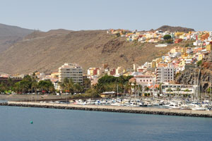
![]() This is Los Cristianos ferry terminal where our excursion to La Gomera island starts. |
![]() A line of vehicles just before embarking is at Los Cristianos ferry terminal. |
![]() Los Cristianos ferry terminal. |
![]() The city of Los Cristianos as seen from Los Cristianos ferry terminal. |
![]() Large investments from Naviera Armas shipping company were needed to construct Volcán de Taburiente ferry. |
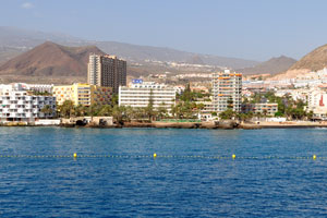
![]() An amazing morning view of Los Cristianos city opens from Volcán de Taburiente ferry. |
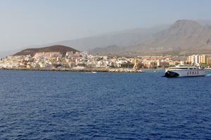
![]() The city of Los Cristianos as seen from Volcán de Taburiente ferry. |
![]() The city of Los Cristianos is on the background of magnificent mountains. |
![]() Tourists photograph Los Cristianos early in the morning from the upper deck of Volcán de Taburiente ferry. |
![]() Volcán de Taburiente is the huge modern comfortable ferry which will get you to La Gomera island from Tenerife. |
![]() Electronic equipment on the top of Volcán de Taburiente ferry is tagged by the Raytheon company logo. |
![]() The lifeboat #2 is on Volcán de Taburiente ferry. |
![]() Fred.Olsen ship. |
![]() Fred.Olsen ferry. |
![]() Fred Olsen's fleet of ships gives an opportunity to visit Tenerife, La Palma and La Gomera. |
![]() There is Roques de Anaga terrace on Volcán de Taburiente ferry. |
![]() The Spanish flag is waving over Volcán de Taburiente ferry. |
![]() Tourists get off the bus on the first observation deck. |
![]() San Sebastián de La Gomera is the capital of La Gomera. |
![]() Hospital General de la Gomera S. Público as seen from the observation deck. |
![]() El Atajo village is on the left and Lomito Fragoso y Honduras village is on the right. |
![]() Numerous agaves grow on the slope. |
![]() Chejelipes dam. |
![]() GM-1 road goes through the mountain tunnels. |
![]() El Atajo village. |
![]() Chejelipes dam can be observed from this observation deck. |
![]() Agaves grow near GM-1 road which goes through the mountain tunnels. |
![]() El Atajo. |
![]() Barranco de la Laja reservoir and Chejelipes dam. |
![]() Lomito Fragoso y Honduras village. |
![]() El Atajo village as seen from a bird's-eye view. |
![]() La Gomera island is of volcanic origin and roughly circular. |
![]() An exotic plant growing at one of the observation platforms. |
![]() Opuntia forms a dense shrub. |
![]() Chejelipes dam as seen from a bird's-eye view. |
![]() Chejelipes village. |
![]() Exotic leafless plants grow on the observation platform. |
![]() Agaves grow abundantly on the slope. |
![]() A deep narrow valley with steep rocky sides. |
![]() Barranco de Monteforte reservoir and dam. |
![]() Roques de San Pedro are in the town of Hermigua. |
![]() Dracaena Draco grows in the town of Hermigua near “Molino de Gofio Los Telares”. |
![]() The grass of Aizoaceae family is in bloom in “Molino de Gofio Los Telares” garden. |
![]() My wife and son are in “Molino de Gofio Los Telares” garden. |
![]() “Averrhoa carambola” tree grows in “Molino de Gofio Los Telares” garden. |
![]() Coat of arms of Hermigua town is laid out on the pavement in “Molino de Gofio Los Telares” garden. |
![]() Mango trees with fruits grow in “Molino de Gofio Los Telares” garden. |
![]() Red geranium also called cranesbill from the genus Pelargonium blooms in “Molino de Gofio Los Telares” garden. |
![]() “Molino de Gofio Los Telares” garden is situated at the foot of mountain. |
![]() A fruitful banana tree with a huge flower grows in “Molino de Gofio Los Telares” garden. |
![]() Banana trees are in “Molino de Gofio Los Telares” garden. |
![]() This is the main footpath of “Molino de Gofio Los Telares” garden. |
![]() An exotic green shrub grows at the entrance to “Molino de Gofio Los Telares” garden. |
![]() “Molino de Gofio Los Telares” garden entrance. |
![]() “Los Telares” crafts shop, tasting and delicatessen. |
![]() Vehicles are at the parking place in front of “Molino de Gofio Los Telares” garden. |
![]() Crassula ovata, commonly known as jade plant, friendship tree, lucky plant, or money tree, grows in “Molino de Gofio” garden. |
![]() “Cooperativa Agrícola Insular Gomera” fruit and vegetable wholesaler. |
![]() Bbva bank. |
![]() Nuestra Señora de la Encarnación church. |
![]() There are banana plantations in Hermigua town. |
![]() Nuestra Señora de la Encarnación church is located in the lowest part of Hermigua valley. |
![]() A seaside mountain slope in Hermigua town is used for agriculture. |
![]() This seaside observation deck has the following geo coordinates: 28°10′51.9″N 17°11′13.2″W. |
![]() This is the interior of the “Restaurante La Zula” restaurant. |
![]() This mountain towers over Agulo village. |
![]() “Restaurante La Zula” is the restaurant in Agulo where the whistling used by inhabitants of La Gomera is demonstrated. |
![]() The winding roads of Agulo village. |
![]() Banana plants grow in Agulo village. |
![]() “Casa Aixa” confectionery is located in Agulo. |
![]() Mountains in Agulo. |
![]() GM-1 is a winding road that goes through Agulo. |
![]() Garajonay National Park was declared a national park in 1981 and a World Heritage Site by UNESCO in 1986. |
![]() Garajonay National Park occupies 40 km2 (15 sq mi). |
![]() “Zona recreativa Laguna Grande” tourist attraction. |
![]() There are wooden statues of donkeys in Laguna Grande park. |
![]() There are wooden statues of Gara and Jonay in Laguna Grande park. |
![]() There are waste containers in Laguna Grande park. |
![]() This asphalt road leads to Laguna Grande park. |
![]() Ancient laurel forest. |
![]() The laurel forest thrives by extracting moisture from low-lying clouds. |
![]() This is the parking place located near “Roque de Agando”. |
![]() GM-2 road goes along “Roque de Agando”. |
![]() Roque de Agando has the following geo coordinates: 28°06′19″N 17°12′49″W. |
![]() Disa San Sebastián gas station is located in San Sebastián de La Gomera town. |
![]() This is the intersection between GM-1 and GM-2 roads. |
![]() Hospital Insular Nuestra Señora de Guadalupe. |
![]() Estación de Guaguas bus station is located in San Sebastián de La Gomera town. |
![]() Estación de Guaguas bus company is located in San Sebastián de La Gomera town. |
![]() GM-1+GM-2 roundabout is located in front of Estación de Guaguas bus station. |
![]() The southwestern part of San Sebastián de La Gomera town. |
![]() “Mercado Municipal San Sebastián” market is found in San Sebastián de La Gomera town. |
![]() Here is Avenida de Colón street in San Sebastián de La Gomera town. |
![]() Bar Restaurante El Baluarte. |
![]() Cajasiete savings bank. |
![]() Here is Calle Profesor Armas Fernández street in San Sebastián de La Gomera town. |
![]() El Barato is a trade organization specializes in childcare and everything for the baby and children from zero months to 18 years. |
![]() Church of the Assumption “Iglesia de La Asunción” as seen from Avenida de Colón street. |
![]() “El Nilo Mario” bar and restaurant. |
![]() Lencería Corsetería Esquine store. |
![]() The facade of “Iglesia de La Asunción” church. |
![]() Calle República de Panamá street is located in San Sebastián de La Gomera town. |
![]() Calle Torres Padilla street is located in San Sebastián de La Gomera town. |
![]() Calle Real street is located in San Sebastián de La Gomera town. |
![]() “Farmacia Ignacio Fernández Galván Pérez” pharmacy. |
![]() There is the dive center on Calle Real street #56 in San Sebastián de La Gomera town. |
![]() Correos post office is located in San Sebastián de La Gomera town. |
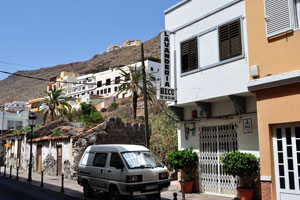
![]() San Sebastián de La Gomera is a multileveled mountainous town. |
![]() Lavandería Hecu laundry. |
![]() This is Calle Real street #106 with the following geo coordinates: 28°05′40.2″N 17°06′46.1″W. |
![]() An ambulance rides in San Sebastián de La Gomera town. |
![]() La Candelaria bar-cafe. |
![]() Viveres Barroso small grocery shop. |
![]() Correos post office. |
![]() Casa de Colón is a museum dedicated to Christopher Columbus. |
![]() Casa de Colón history museum. |
![]() Church of the Assumption “Iglesia de La Asunción”. |
![]() This altar with Jesus is inside the Church of the Assumption. |
![]() La Salamandra restaurant. |
![]() These comfortable benches are situated on Calle Real street. |
![]() Plaza de la Constitución square. |
![]() Modernistic bust of Columbus is implemented by Mexican sculptor Raúl de la Rosa on a column. |
![]() Gigantic trees grow on Plaza de la Constitución square. |
![]() We have bought the “Molino de Gofio” flour in this souvenir shop located on Plaza de la Constitución square. |
![]() Calle Real street connects to Plaza de la Constitución square. |
![]() We have bought the “Molino de Gofio” flour in this souvenir shop located on Calle de Ruiz de Padrón. |
![]() The fountain is functioning in Torre del Conde park. |
![]() Torre del Conde. |
![]() Torre del Conde park. |
![]() The benches are installed around the perimeter of Torre del Conde park. |
![]() A huge euphorbia tree grows in Torre del Conde park. |
![]() Apartamentos Quintero is a 1-star hotel. |
![]() Trees with stunning red flowers grow on Calle de Ruiz de Padrón street. |
![]() Avenida de los Descubridores avenue. |
![]() Kiosko Ramón bar & grill. |
![]() Playa De La Punta beach is located in San Sebastián de La Gomera town. |
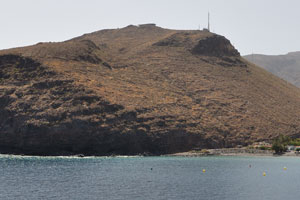
![]() Los Garañones cape as seen from Playa De La Punta beach in San Sebastián de La Gomera town. |
![]() Naviera Armas ferry as seen from Playa De La Punta beach in San Sebastián de La Gomera town. |
![]() This bridge spans over Barranco de la Villa in San Sebastián de La Gomera town. |
![]() Protected by Los Garañones cape, Playa De La Punta beach allows for fun in the water without high waves. |
![]() Naviera Armas ferry as seen from Playa De La Punta beach. |
![]() A few metres away from the centre of town, the capital has a beautiful beach, Playa De La Punta. |
![]() This children playground is mounted on Playa De La Punta beach in San Sebastián de La Gomera town. |
![]() It is not a good idea to mount this children playground just few meters away from the road with a high traffic in San Sebastián de La Gomera town. |
![]() Bright tile on the street is a map informing about how Columbus traveled. |
![]() This roundabout between Avenida de los Descubridores and Calle de Ruiz de Padrón has the following geo coordinates: 28°05′24.37″N 17°06′37.19″W. |
![]() Ayuntamiento de San Sebastián de la Gomera town hall. |
![]() An information board in San Sebastián de La Gomera reads “Environmental restoration of Garajonay National Park and its surroundings post the big fire of 2012”. |
![]() An information board in San Sebastián de La Gomera reads “Camino Natural Cumbres de la Gomera”. |
![]() This forgotten and dilapidated monument in San Sebastián de La Gomera town depicts the globus and the ship. |
![]() Instituto Social de la Marina de San Sebastián de la Gomera local government office. |
![]() Here is Paseo Fred Olsen street in San Sebastián de La Gomera town. |
![]() “Laurisilva, productos típicos y souvenirs” souvenir store. |
![]() “El Charcon” provisional underground access to Playa de la Cueva beach. |
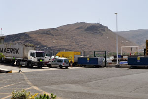
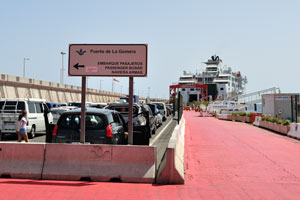
![]() The port of San Sebastián de La Gomera town. |
![]() This fork intersection connects Calle Cañadas las Palomas to Paseo Fred Olsen. |
![]() San Sebastián de La Gomera town as seen from the sea. |
![]() Marina la Gomera as seen from the sea. |
![]() There is pasteleria inside Volcán de Taburiente ferry. |
![]() The indoor terrace is an unquestionable hit amongst Volcán de Taburiente's passengers. |
![]() Volcán de Taburiente's passengers are watching the sea. |
![]() Los Cristianos town as seen from Volcán de Taburiente ferry. |
![]() Naviera Armas ferry crossing the ocean is photographed on the background of Los Cristianos town. |
![]() Puerto de Los Cristianos. |
![]() Los Cristianos town. |
![]() Los Cristianos town is on the background of mountains. |
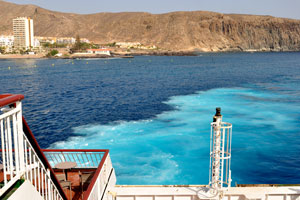
![]() The turquoise water is produced by Naviera Armas engines while docking at ferry slip of Puerto de Los Cristianos port. |
![]() This music bar is found on the back deck of Volcán de Taburiente ferry. |